Mapped Parkland Double Dipping
May 14th, 2017 Posted in Define the IssuesThe application (C 060057 MMX) for an amendment to the City Map was filed by the Department of Parks and Recreation, pursuant to Sections 197-c and 199 of the New York City Charter on August 9, 2005. It involves: the establishment of a park between Major Deegan Boulevard and the Harlem River; and any acquisition or disposition of real property related thereto.
Mill Pond Park is mapped parkland. It is Block 2539, Lot 2 Entire Lot as per ULURP 060057 ULURP Parks and then the mapping 2006061302436001&page (1-10) Acris MPP Map hilite
The current proposal intends to use the south west unimproved part of a mapped park for private use.
In the FINAL Scope of Work, on page 2-3, (16DME012X_Final_Scope_of_Work_03152017 hilite, is the following statement as footnote 3.
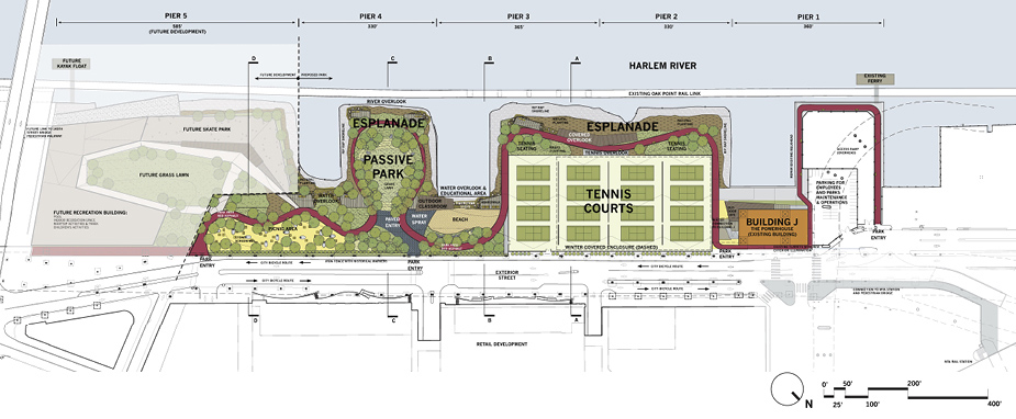
The proposed extension would be contiguous with the existing Mill Pond Park but it would not be mapped parkland. It would be
publicly accessible open space that would be maintained by the future developer.

Related Posts:


Sorry, comments for this entry are closed at this time.